


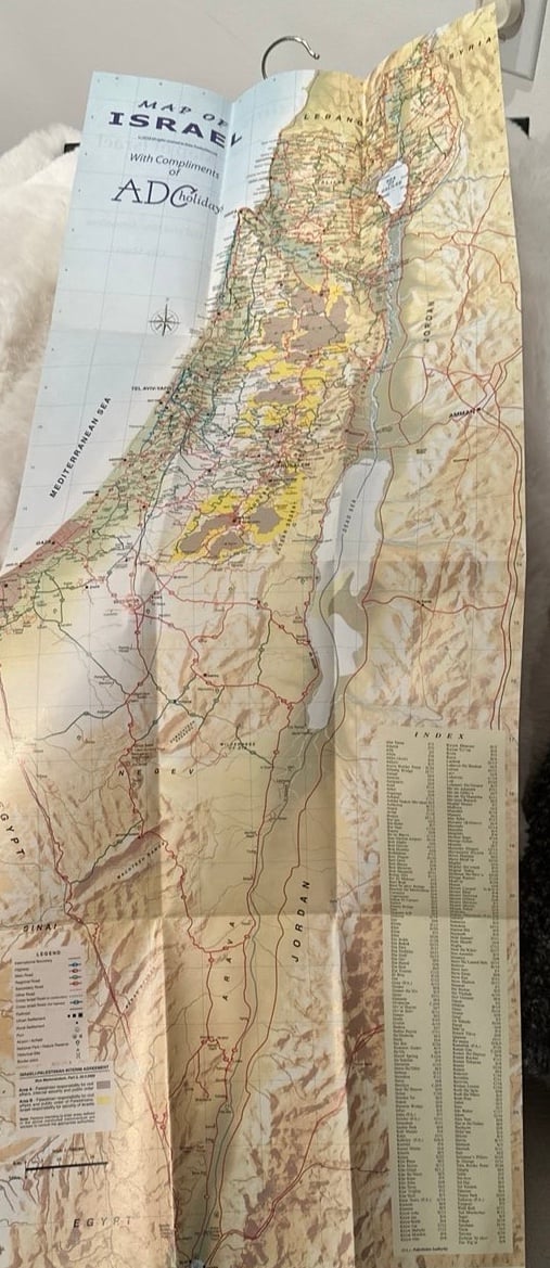
Vintage Map 1978 National Geographic Middle East History Geography Classroom

 4.3 (34 items)
 Limited Time Sale
$5.60 cheaper than the new price!!
Free cash-on-delivery fees for purchases over $99
Product details
| Management number | 7253790 | Release Date | 2025/08/21 | List Price | $8.39 | Model Number | 7253790 | ||
|---|---|---|---|---|---|---|---|---|---|
| Category | |||||||||
This map was printed in 1978 by National Geographic Magazine, showing the Middle East.
At this time Israel had occupied the West Bank, Sinai Peninsula, and Golan Heights for nearly a decade. It was 6 months after printing of this map that Israel signed a treaty and withdrew from the Sinai.
Map measures approx 37 x 23. Does show some age wear, no staining or tears. Suitable for classroom display and home school use, and decor.
From a smoke free home. Thank you for looking !
lr/bin4/21425
| Category | Vintage & collectibles > Paper ephemera > Map |
|---|---|
| Size | N/A |
| Brand | National Geographic |
| Condition | Good |
Winch Straps

Map


Correction of product information
If you notice any omissions or errors in the product information on this page, please use the correction request form below.
Correction Request Form