


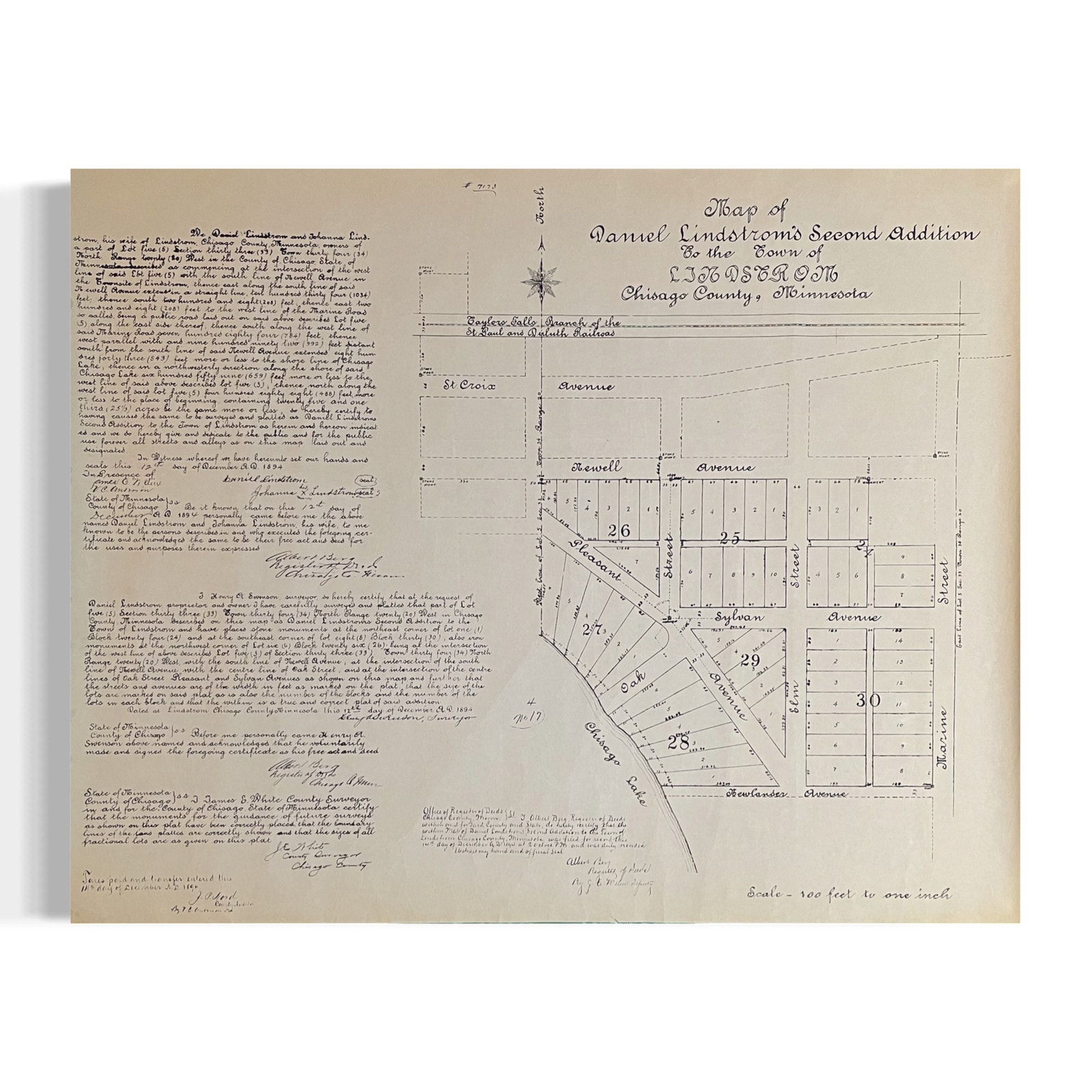
Antique 1847 Map Of Portsmouth Harbor New Hampshire by Edmund M. Blunt

 4.1 (52 items)
 Limited Time Sale
$52.00 cheaper than the new price!!
Free cash-on-delivery fees for purchases over $99
Product details
| Management number | 6455892 | Release Date | 2025/08/22 | List Price | $77.99 | Model Number | 6455892 | ||
|---|---|---|---|---|---|---|---|---|---|
| Category | |||||||||
Detailed Portsmouth map features historical landmarks and coastal details.
The image shows a map of Portsmouth Harbor, engraved for the American Coast Pilot and published by Edmund M. Blunt in 1816. The map details the harbor's islands, depths, and navigational hazards, including Gerrishes Island, and areas marked as "Very dangerous." A compass rose indicates directions, and a scale shows the distances in miles. The map provides a historical view of the harbor's layout and navigational information from the early 19th century.
Minor discoloration and burn mark on the top right corner. Paper overall aged with visible wear. Measurements: 7.5 inches x 4.5 inches.
Condition: Pre-Owned Good
| Category | Vintage & collectibles > Paper ephemera > Map |
|---|---|
| Size | N/A |
| Brand | None |
| Condition | Good |
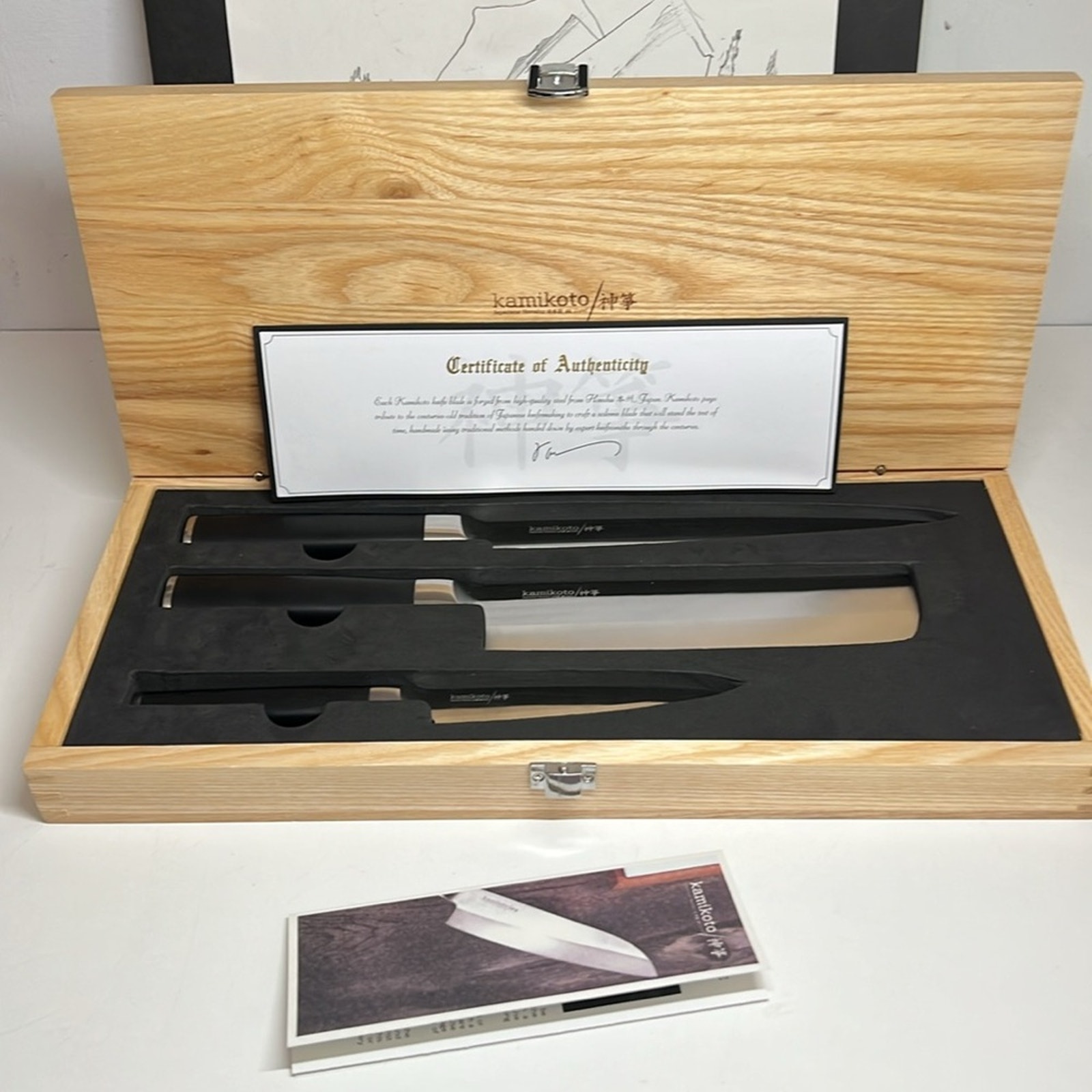
Kitchen Steak Knives


Map


Correction of product information
If you notice any omissions or errors in the product information on this page, please use the correction request form below.
Correction Request Form